Ambulance Fleet Tracking in the UAE: What It Is and Why Seconds Are the Only Metric That Counts
Ambulance and emergency fleet tracking uses high-frequency GPS telemetry, automatic vehicle location (AVL) and status-aware dispatch to get the nearest available emergency unit to the scene as fast as possible, and then to prove exactly how long each stage took. A commercial platform is built to cut cost per kilometre. An emergency platform is built to cut seconds to the patient. That one difference changes nearly every design decision that follows.
The UAE has already turned this into a measurable national target. Dubai Corporation for Ambulance Services (DCAS) recorded an average response time of approximately seven minutes in 2025 and is working toward four minutes by 2033, and handled more than 279,000 emergency calls through its smart reporting system in a single year. You won't take three minutes off a seven-minute median by training dispatchers harder. It's a data-latency problem, and telemetry is how you solve it.
The road network sets the stakes. The UAE recorded 384 road deaths in 2024, a 9 percent rise on the 352 recorded in 2023, along with 6,062 injuries. Dubai accounted for 158 of the fatalities and Abu Dhabi for 123. Each of those incidents triggered an emergency dispatch, and in each one the gap between the call and the arrival was what mattered. This guide covers what an emergency tracking stack has to do differently, what UAE regulators require of ambulance operators, how to measure and report response times honestly, and what it all costs.
How Emergency Fleet Tracking Differs From Commercial Fleet Tracking
The Optimisation Target Flips From Cost to Latency
A logistics platform is tuned to cut fuel burn, idle time and unplanned maintenance. For those goals, a GPS update every 30 to 60 seconds is fine, because where a delivery van was 45 seconds ago is close enough to bill against. For an ambulance it isn't. A city ambulance at 80 km/h covers roughly 1.1 kilometres in 50 seconds, and that's enough to change which unit is really closest to an incident on Sheikh Zayed Road. Dispatch on stale positions and you don't get a slightly worse choice now and then. You get the wrong unit, repeatedly, while the map looks perfectly fine.
That's the gap between real-time and passive GPS tracking, measured in clinical terms. Emergency fleets need real-time GPS tracking at intervals under 10 seconds while a unit is moving, with dead-reckoning to carry it through the tunnels and underground car parks Dubai's road network is full of.
Availability Becomes a Safety Requirement, Not an SLA Clause
When a commercial tracking platform goes down for two hours, a fleet manager loses two hours of reports. When an emergency dispatch platform goes down for two hours, the control room falls back to voice radio and paper, and response times get worse across a whole emirate until it's back. So emergency buyers ask about redundancy, failover and offline behaviour long before they ask about dashboards.
In practice that means three things. You need dual-SIM or multi-network M2M connectivity, so a unit doesn't go dark when one carrier has a cell-site fault. You need on-device buffering that stores every position fix recorded during a coverage gap and forwards it later, so the audit trail has no holes. And the control-room client has to keep working on a poor connection. If you're evaluating platforms properly, read the government fleet tender and compliance guide too, because emergency procurement in the UAE follows government tender logic even when the buyer is a private operator.
The UAE Emergency Response Landscape: Who Operates What
Dubai: DCAS and the Seven-Minute Baseline
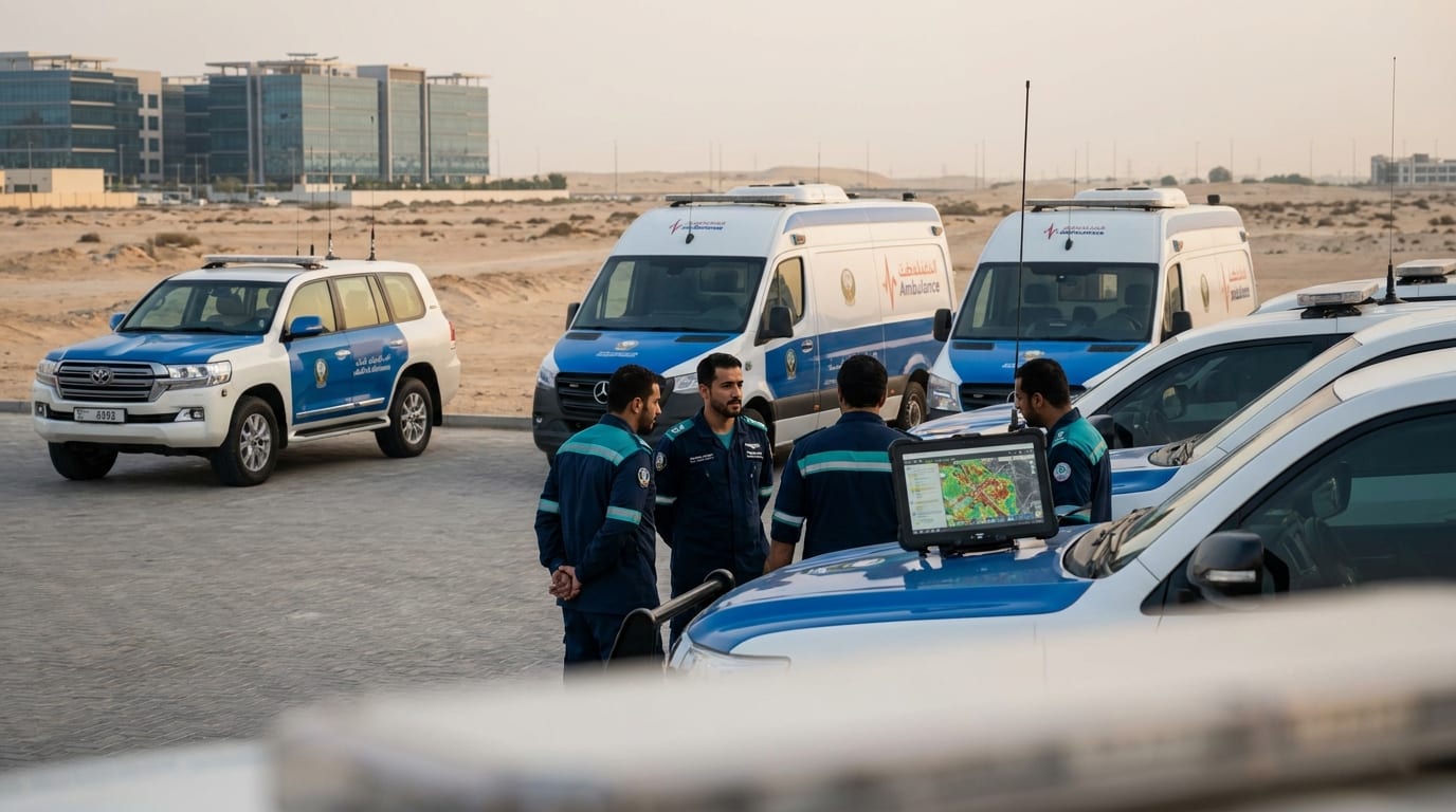
DCAS runs Dubai's public ambulance service and also regulates it. It uses AI-assisted triage, telemedicine links into hospital emergency departments and geographic information systems for resource planning, and it publishes the response-time target the whole emirate gets measured against. If you're a private operator in Dubai, you're being measured against that seven-minute public benchmark too, whether anyone says so or not.
Dubai has also built the traffic side of the problem. Control rooms can hold traffic signals to open a green corridor along an ambulance's route. That only works as well as the position and heading data feeding it, so anyone integrating with it has a hard minimum for telemetry quality.
Abu Dhabi and the Northern Emirates
National Ambulance covers Sharjah, Ajman, Ras Al Khaimah, Fujairah and Umm Al Quwain, and it's the clearest published evidence in the region that investing in telemetry and dispatch moves the number. Its Northern Emirates response time fell from 18 minutes 12 seconds in February 2014 to 8 minutes 29 seconds by December 2018. That's a 48 percent cut over five years, credited to strategic vehicle positioning, an upgraded computer-aided dispatch system and electronic links with police and civil defence. In the first half of 2025 the service completed 47,269 emergency missions, treated more than 19,400 people on scene and took more than 27,800 to hospital.
Abu Dhabi has been working on the vehicle end. In August 2026 the Department of Health – Abu Dhabi and Abu Dhabi Civil Defence Authority launched 18 smart ambulances across three categories: intensive care, maternal and neonatal, and bariatric. All of them connect to the Unified Medical Operations Centre, which shares data in real time between field teams and hospitals. Specialised categories change the dispatch problem completely. If the call is an obstetric emergency and the closest unit is a bariatric transport, the nearest ambulance is the wrong one.
The Private and Industrial Operators Nobody Counts
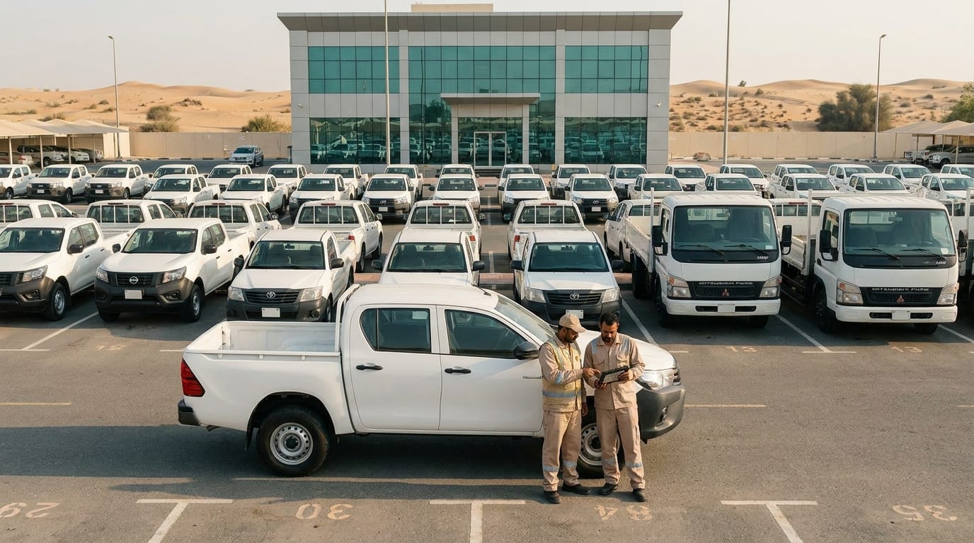
Behind the public services there's a big fleet most people never notice. Licensed private ambulance companies handle inter-facility transfers, event medical standby and repatriation. Industrial sites like ADNOC facilities and plants in KEZAD and JAFZA keep their own emergency units. Hotels and malls run first-response vehicles, and private security firms run rapid-response fleets. For these operators, tracking is usually a contract term. It's a client SLA promising a medical unit on scene at a construction site within so many minutes, with the log to prove it.
Here the tracking platform is the billing evidence. If you can't prove a response time, you can't bill for it, and if it's disputed, you've got legal exposure. That's why emergency response fleet management is its own product line and gets built separately from standard fleet management.
The Six Tracking Capabilities Every UAE Emergency Fleet Needs
1. High-Frequency AVL, Not Standard Fleet Pings
You want a position update every 5 to 10 seconds while the unit is moving, with heading and speed, and dead-reckoning to bridge GPS shadows. Go slower than that and the closest-unit calculation falls apart in dense city traffic, which is exactly where response time matters most.
In the UAE this has a hardware cost. The tracker has to hold a fix and keep reporting at ambient temperatures above 50 °C, in a vehicle that idles for long stretches with the patient compartment air conditioning running. Consumer-grade trackers drift or reset in those conditions. Specify automotive-rated hardware and get the operating range confirmed in writing during GPS tracker installation.
2. Status-Aware Dispatch: Position Plus Crew State
Knowing where a unit is doesn't tell you whether it can go. An ambulance parked at Rashid Hospital might be the nearest dot on the map and still completely unavailable: the crew is mid-handover, the vehicle's being restocked, or it's already committed to a transfer. A dispatch-grade platform tracks each unit's state next to its position. Available, mobile to scene, on scene, transporting, at hospital, out of service, on break.
The crew has to be able to set that state with one touch from the cab. If a paramedic has to stop and type a status, it won't get updated. Once state and position are combined, dispatch stops recommending the nearest dot and starts recommending the nearest unit that can actually respond. In most emergency fleets, that's the biggest source of avoidable delay.
3. Geofenced Response Posts and Automatic Coverage Gaps
Emergency fleets use dynamic deployment. Units wait at standby posts chosen so coverage stays even across a district. Geofencing turns each post into a monitored zone, so the platform alerts you when a unit leaves its assigned post. The more valuable alert fires when a district has no coverage left because every unit in it has been sent somewhere.
That second alert prevents a classic failure. Three calls come in at once in one district, units get pulled in from next door, and nobody notices the neighbouring district is empty until the fourth call arrives. The mechanics are the same as any zone-alert setup, covered in the UAE geofencing guide. Here, though, the job is guaranteeing coverage. Theft has nothing to do with it.
4. Driver Behaviour Scoring Calibrated for Blue-Light Driving
Put an ambulance driver on a standard driver behaviour monitoring profile and it'll flag them on every legitimate run: harsh acceleration, speeding over the posted limit, aggressive cornering. Leave it like that and you get a report everyone learns to ignore. That's worse than having no report.
Emergency fleets need two profiles. The normal one applies when the unit isn't on an emergency call. A relaxed blue-light profile switches on automatically when the unit's state is "mobile to scene" with lights and sirens running. The blue-light profile still flags the things that actually predict collisions: speed entering junctions, unsecured lateral G, and following distance. The full method is in the driver behaviour monitoring guide, and it ties straight into fleet safety and compliance reporting.
5. In-Vehicle Cameras for Incident Defence and Clinical Governance
Emergency vehicles end up in more than their share of junction collisions, and people tend to assume the emergency driver was at fault. Forward-facing and cab-facing vehicle cameras that upload on events and sync to the GPS track turn a disputed claim into a settled one. It's the same evidence logic covered in the multi-camera dash cam guide.
Cameras in the patient compartment are a separate, sensitive question. They have real clinical-governance value, and they come with equally real patient-privacy obligations under UAE health data rules. If you use them at all, do it with a written retention policy, tight access controls and a clear legal basis. Don't switch them on by default.
6. Medical Payload and Asset Telemetry
The vehicle isn't the only thing worth watching. Drug fridges, blood products and vaccines on board all have set temperature ranges, and if the temperature drifts out of range the payload spoils without anyone noticing. Temperature monitoring on the medical fridge, using the same cold chain tracking approach used for pharmaceutical transport, gives you the continuous log a health regulator will ask to see.
Expensive portable kit (defibrillators, ventilators, transport monitors) is worth tagging with asset tracking. The problem it prevents is boring and costly. A monitor gets left at the receiving hospital, and nobody realises until the next call.
Built for units that cannot go dark
IOTee's emergency response fleet platform gives you high-frequency AVL, status-aware dispatch, geofenced response posts and blue-light driver scoring, on heat-rated hardware installed in the UAE.
Compliance: What UAE Regulators Require of Ambulance Operators
Dubai: DCAS Authorisation and Executive Council Resolution No. 30 of 2011
In Dubai, ambulance services are governed by Executive Council Resolution No. 30 of 2011. Article 4 leaves no room for doubt: nobody may carry out any ambulance service activity in the emirate without the licence or authorisation the resolution requires. Article 7(14) also bars establishments from operating any ambulance that doesn't meet the standards DCAS adopts for ambulances.
Two more obligations in the same article line up exactly with what a tracking platform produces. Article 7(10) requires monthly reports on cases handled and transport routes. Article 7(6) requires vehicle and equipment records to be kept for at least three years. If you're building route reports by hand from run sheets, you're doing work you don't need to, and your evidence is weaker than the automatic trip log any decent GPS tracking platform already stores. It's the same compliance-through-telemetry pattern behind SecurePath and Asateel obligations for commercial fleets, and you can check where you stand overall with the UAE GPS compliance checker.
Abu Dhabi: DoH EMS Standards and Centralised Operations
Abu Dhabi's Department of Health publishes ambulance and EMS standards covering vehicle specification, crew qualifications and clinical documentation. The emirate is also pulling operational visibility together through the Unified Medical Operations Centre, which the 2026 smart ambulance fleet feeds into. The direction is clear: one operational picture across all providers, with no operator left in its own silo.
For anyone operating in Abu Dhabi, that makes integration the thing to check. Ask vendors straight out whether their platform has a documented API and can push position and status to an external command centre. A closed platform that only shows its own dashboard will, sooner or later, be the reason you can't join a mandated integration.
The Right-of-Way Law Cuts Both Ways
UAE law protects the emergency corridor firmly. Failing to give way to emergency, ambulance and police vehicles brings a Dh3,000 fine, six black points and a 30-day vehicle impoundment, and obstructing rescue work in bad weather is punished more heavily.
That's exactly why an emergency operator needs its own record that will stand up. When a motorist is fined for obstruction, or contests the fine, the ambulance's synced GPS track and forward camera footage show where the unit was, how fast it was going and whether its lights and siren were on. Without that record, you're relying on what the crew remembers, in a dispute you never asked for.
Response-Time Analytics: What an EMS Director Should Report Monthly
Break the Interval Into Its Four Segments
Report response time as one number and you can't see where the delay sits, so you can't fix it on purpose. Measure and report four intervals separately:
- Call-to-dispatch: from call answered to unit assigned. This one belongs to the control room and triage.
- Dispatch-to-mobile: from assignment to the unit actually rolling. It measures crew readiness and vehicle availability.
- Mobile-to-scene: the drive itself. Routing, posting and traffic drive it, and it's the only segment most fleets bother to optimise.
- Scene-to-hospital: transport time, mostly decided by destination choice and hospital availability.
Fleets that split the interval for the first time nearly always find dispatch-to-mobile is bigger than anyone thought. Good news, really. It's the cheapest segment to fix, because it doesn't need a single new vehicle.
Report the 90th Percentile, Not the Average
The mean response time flatters an emergency service. The 90th percentile tells you about its worst hour. A fleet with a seven-minute mean and a nineteen-minute 90th percentile has a serious coverage problem, and the mean hides it completely. That's why international EMS practice reports percentiles. If a platform can only give you the average, it isn't really doing analytics.
Break the percentile down by hour of day, by district and by season. In the UAE, season matters more than most people expect. Pre-iftar traffic in Ramadan, the summer heat peak that pushes up both heat-related calls and strain on vehicles, and winter fog on the Abu Dhabi–Dubai corridor each create their own performance pattern, and an annual average wipes all of them out.
What It Costs to Track a UAE Emergency Fleet
Hardware, Installation and Platform
Indicative UAE pricing for a mission-critical emergency setup. Treat this as a worked example; it isn't a quote, and real figures depend on vehicle type, camera count and how much integration you need:
- Ambulance and EMS vehicle bundle: roughly AED 6,500 per vehicle, covering the GPS and AVL unit, dispatch integration, driver monitoring and installation.
- Civil defence and fire apparatus bundle: roughly AED 7,500 per vehicle, adding apparatus telemetry and fastest-route navigation.
- Platform subscription: roughly AED 300 per vehicle per month for a government-grade tier with redundant infrastructure and 24/7 support, compared with a typical AED 60 to 120 for standard commercial fleet tracking systems.
That subscription gap is the whole point. The higher tier buys an uptime commitment, failover and fast support. Those only matter on the day something breaks, and that's the one day an emergency fleet can't afford.
A Worked Example: A 25-Vehicle Private Ambulance Operator
Say you run 25 ambulances on the AED 6,500 bundle and the AED 300 monthly tier. That's AED 162,500 up front and AED 90,000 a year for the platform, so AED 252,500 in year one, then roughly AED 90,000 a year until the hardware needs refreshing.
Don't try to justify it with fuel savings. For an emergency fleet the return comes from three places. Response-time evidence makes SLA-backed contracts billable and defensible. Collision-liability defence matters too, since one successfully contested at-fault claim can cost more than the platform does in a year. And availability improves, because fleet maintenance scheduled on real engine hours, instead of calendar dates, keeps more units on the road. If you want to model the everyday operating savings separately, use the fleet savings calculator, and the fleet maintenance system guide goes deeper on availability.
Choosing a Vendor: The Questions That Separate Mission-Critical From Ordinary
Ask About Failure, Not Features
Every vendor demo shows the platform working. What you need to know is how it behaves when something goes wrong. Ask:
- What happens to position data when a vehicle loses cellular coverage for 20 minutes? Is it buffered on the device and backfilled, or lost?
- What's the contractual uptime commitment, and what's the remedy when it's missed?
- Where is the data hosted, and does it stay in the UAE?
- What's the support response time at 03:00 on a Friday, and is that team in the UAE?
- Does the platform have a documented API for pushing position and status to an external command centre?
- Can it hold two driver-behaviour profiles and switch between them based on vehicle status?
- Who does the installation, and are they certified for the vehicle's electrical system and warranty?
If a vendor can't give a specific answer on buffering, they haven't built for emergency use. Ignore the brochure.
Ask About the UAE Physical Environment
Hardware built for a European fleet fails in different ways here. Summer temperatures above 50 °C, long idling under heavy electrical load, dust, and GPS multipath between the towers of Dubai Marina and central Abu Dhabi all fall outside what a temperate-climate design expects.
Get the operating temperature range as a written spec. Check that the device can handle long idling without draining a battery that also powers medical equipment. Ask for UAE emergency-sector reference sites you can actually call. A vendor with its own local installation team and existing government fleet deployments is a much lower risk than a reseller shipping hardware in from abroad, as the wider UAE GPS tracking market overview shows.
Where to Start
Instrument First, Optimise Second
The approach that works is unexciting. Start by measuring the four response-time segments on your current fleet and reporting the 90th percentile for 60 days, without changing anything operationally. That baseline lets you argue every later decision from evidence. It almost always shows the problem is somewhere other than where the fleet assumed.
Then make changes. Status-aware dispatch fixes dispatch-to-mobile. Geofenced posts and coverage alerts fix mobile-to-scene. A blue-light safety profile makes driver reports believable enough that crews actually pay attention to them. If you're doing this as part of a wider fleet programme, read the complete UAE fleet management guide for the platform basics everything above assumes.
Get a response-time baseline for your fleet
IOTee installs across the UAE, with segment-level response analytics, DCAS-ready route reports and 24/7 local support on a government-grade uptime tier.